AfriGIS GISlike™ provides a simple and intuitive platform to answer WHERE.
Display trends visually on Thematic maps
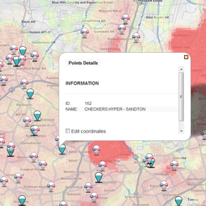
Create and manage GeoNotes
Advanced search capabilities to find places and things
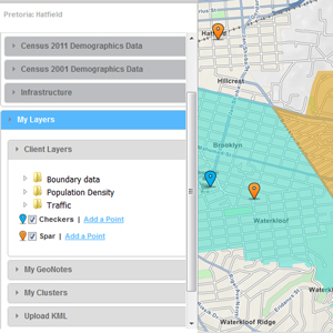
Add your own datasets
View demographic indicators
Create sales regions
Cluster display functionality to view large numbers of point data
Easy-to-use query builder
Upload Google KML files
Seamless integration with AfriGIS Forms
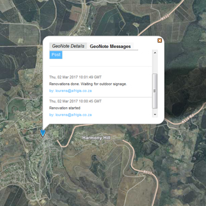
GeoNotes
GeoNotes enable users to add notes on a map. These notes can be shared between team members providing an interactive communication portal between members. Historic content is saved and real-time notifications appear when new content is added.
Demographic indicators
A wealth of demographic information is available per suburb that includes data from both the 2001 and 2011 Census surveys. Additional information is also available, including points of interest (POI), road infrastructure, National Address Database (NAD) and erven counts.
Sales regions
Based on the wealth of available suburb information in GISlike™, creating sales regions for a specific target market is easy. Users can create custom regions with an easy-to-use query builder or by manually selecting the relevant suburbs.
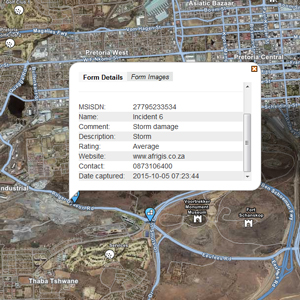
AfriGIS Forms Integration
AfriGIS Forms captures information where it happens and works on any tablet or smartphone. AfriGIS GISlike™ integrates seamlessly with AfriGIS Forms allowing users to view the geo-location and content of captured forms. Try it here: www.afrigisforms.co.za
Understand demand and supply for our products or services in your trade areas.
View Census Data, Postal Codes and Points of Interest (POI) with your own information on heatmaps for new insights.
Share maps online and collaborate on an interactive map. Get on the same page.
View your field data and information in relation to Census Data, Postal Codes and your competitor's footprint.